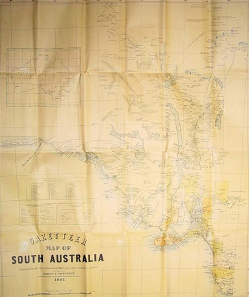
Bailliere's South Australian Gazetteer Map 1867 (folded)
Gould Books
- SKU:
- GBB054
- Availability:
- Usually Ships in 2 to 3 Days
Media: MAP
Author: R. Whitworth
Year: (1867) 1991
Other: 640mm x 750mm, folded, colour
Publisher: Gould Books
If you're looking for an old map of South Australia, this is one for you. This map is a facsimile copy of the 1867 map drawn by Robert P. Whitworth, and originally published as a fold-out map in the "Bailliere's South Australian Gazetteer 1867". Finding an original copy of this map is extremely rare, as most have been removed from the original books.
At a scale of 30 miles to 1 inch, it is remarkably detailed, and shows just how many places were known back in that time. The map has the various District Councils coloured in different shades, provides details of the post towns that are with 8km of Adelaide, and shows the boundaries of South Australian Counties, Council Boundaries, Railways and District Councils, Telegraph Lines, Roads, Rivers, Hills and Ranges, Postal and Other Towns and, Mines.
There are plenty of places around Adelaide mentioned, but with the small writing it is hard to make everyone out, but definiatley the places beyond the metro region are very readable.
Places mentioned down south include: Kingston, Narracoorte, Robe, Penola and Gambier Town. Up north there is Blanche, Strezlecki Creek, Hope Plains, Bagot Range. Kangaroo Island is well noted with places named all over it.
Perfect for the map collector, or historian or genealogist wishing to know more about South Australia's early history.
A folded copy of the map is included with every copy of the gazetteer bought, but additional copies may be purchased either folded or as a laminated flat map - ideal for mounting for display.
Related Products

 AUD
AUD
 USD
USD
 NZD
NZD
 GBP
GBP
 Euro
Euro


